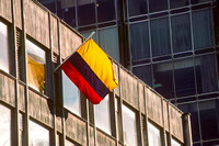
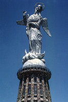
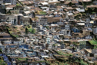
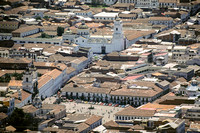
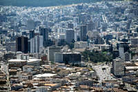
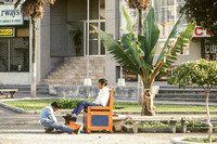
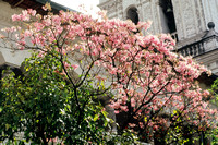
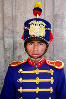
This gallery includes photographs made during the summers of 1984-86, 1991, and 1994. Images are from the highlands around Otavalo in the north to Riobamba in the south and from my excursions to Tinalandia Lodge on the Pacific slope of the Andes. We always began our workshop with a city tour of Quito - a combination of bus ride and walking. The next day, we drove north, visiting the Equatorial Monument and towns such as Calderon, Cotacachi, and Peguche. We stayed at the Hacienda Cusin so that we could get an early Saturday morning start at the famous Otavalo market. In the afternoon we returned to Quito by way of the extinct Imbabura volcano and Lago San Pablo. The following day usually featured an all-day excursion to Cotopaxi National Park, where if conditions were favorable, we could drive the bus up to 4,876m elevation at the edge of the snowline for some high-altitude strolling. After our time in the highlands, we drove from Quito over the Pacific side of the Andes to Tinalandia Lodge near Santo Domingo de las Tsachilas for a rainforest experience. This Lodge was built in 1950 by Ernestine (Tina) Platanoff, a Russian emigrant, and her husband Vladamir as a birding destination. Interestingly, it also featured a nine-hole golf course that became popular with Ecuadorian military officers. In 2020, it was offered for sale at $2.6M/US and does not seem to be open as of April 2021.
After three nights at Tinalandia, we returned to Quito and flew out the next day to Galapagos via Guayaquil. In 1986, I decided that we would replace our Quito-Guayaquil flight with a drive 300km south on the Pan American Highway route known as the Avenue of the Volcanoes. This stunningly scenic drive offers closeup views of seven volcanoes over 5,000m. We broke up the drive with a day visit to Cotopaxi National Park and overnight at the four hundred year old Hacienda Cienega where the Ecuadorian Revolution was planned in 1809. We spent the coldest night of my life at the Hotel Galpon in Riobamba. Strangely, the hotel featured a deliciously heated swimming pool with views of Chimborazo and Tunghuragua volcanoes. The next day we steadily dropped almost 3,000m elevation as we motored into Guayaquil. The solid red lines on the map show the ground routes covered in our charter bus; the dotted lines are our flights (green into the Amazon; blue to/from the Galapagos)